|
|
|
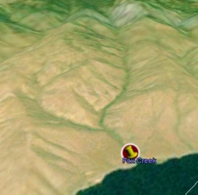
A composite topographic and satellite map of Fox Creek, looking northwest from Brownlee Reservoir. The Fox Creek Canyon is slightly right of center. Fox Creek Dry Gulch is the tributary that enters from the middle-left, and is mostly in the adjoining Daybreak Ranch property. Fox Creek deeded property, as well as its "sphere of influence," is primarily determined by the two ridge lines that run along the west and east sides and the two large benches on either side of the creek near the reservoir. The canyon which is visible in the upper left is Hibbard Creek which is owned by Daybreak Ranch and BLM. The canyon visible on the extreme right is Connor Creek, which is owned by BLM. The light colored hills at the top are the marble cliffs that lie on BLM property. Beyond the marble cliffs lie the upper Fox Creek basin and Lookout Mountain.
|
|
|
|
|